Sedona’s splendor lies in the red-rock landscape that the city blends into. The red sandstone plays both the background and foreground of this Arizonan city, such that its lithic attractions are pretty much within the city limits. And what better way to see these rocks up close than to hike into the rocky wilderness that embraces the city?! Devils Bridge was our pick, this time.
Devils Bridge
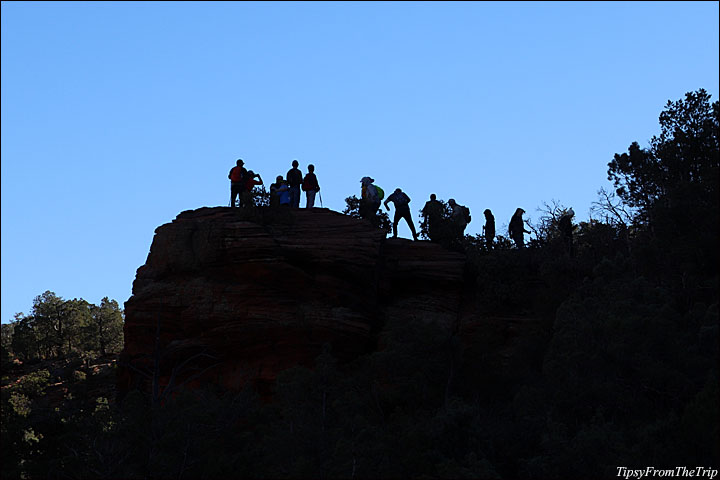
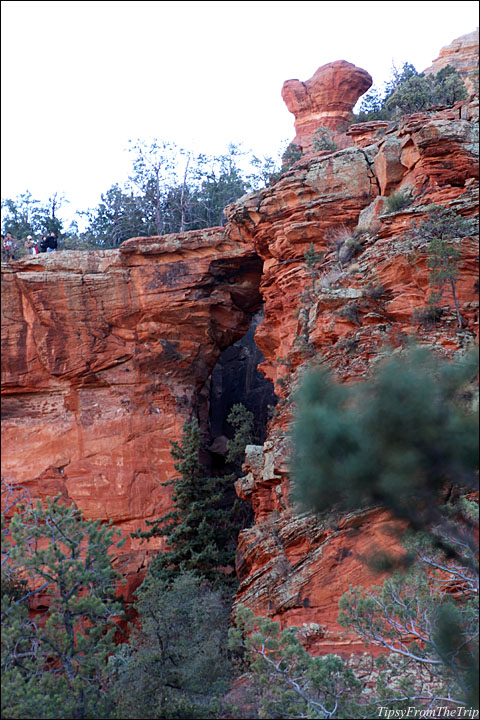
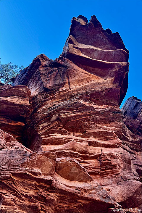
Sedona’s Devil’s Bridge is among the top landmarks of the area. Devil’s Bridge is also said to be the largest of the arches in the Sedona area. It’s a spectacular sight from afar, a picture of tall natural columns supporting a bridge high up in the air. Go to the top, and you can survey a landscape of red rocks!
The Trail
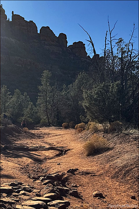
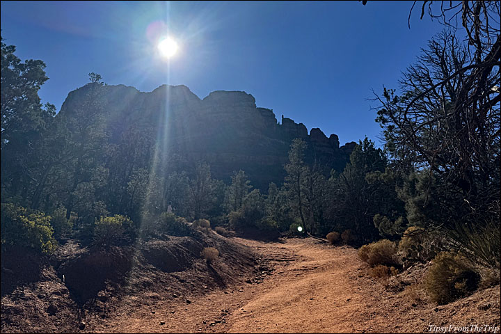
Several trails lead to this natural arch. We chose to take the Dry Creek Route, so we drove a short distance out of town, drove down Dry Creek Road and began our hike through a portion of the unpaved part of the road. Since it was a winter morning, it turned out to be a pleasant walk, with us stopping every now and then to let ATVs pass, leaving a plume of red clouds on the trail, which also made for a fun, colorful hike.
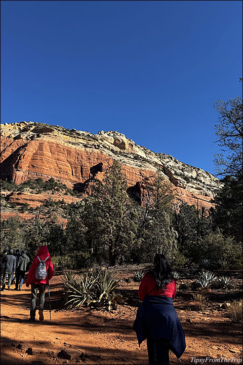
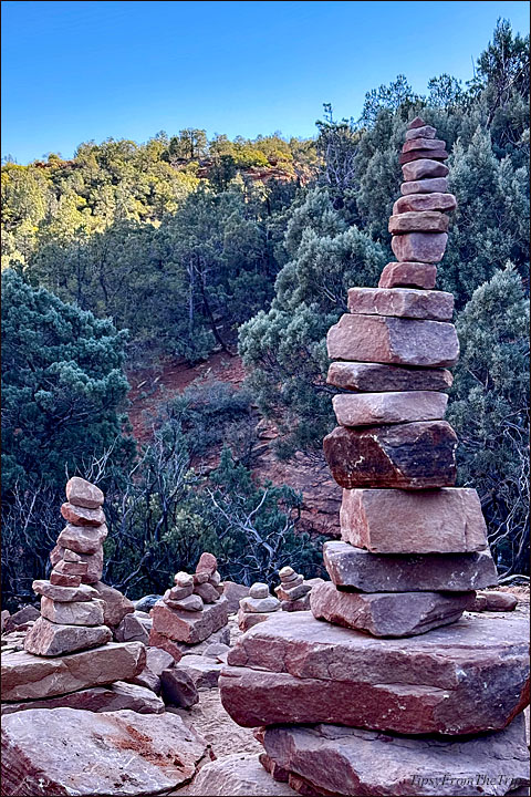
A mile down the road, we turned onto Devil’s Bridge trail, and the path began to get rocky and uphill, interspersed with stones that served as steps, and dusty cactuses decorating the sides. There were even some rock cairns adding drama to the landscape. More than half the way up, we paused on a cliff that offered us sweeping views of a land made almost entirely of red rocks, and a little sprinkle of desert vegetation!
Views from the Trail


Things to know before you hike to Devils Bridge
- The full hike to Devil’s Bridge Via Dry Creek Trail is almost 4 miles.
- This one is an out-and-back trail
- As for the difficulty, it’s categorized as ‘moderately challenging’
- If I’d hiked that way on a hot summer’s day, I’m sure it would swear it was a highly-challenging one for me. (There have been incidents of hikers needing to be rescued from the area on hot summer days)
- This trail has an elevation gain of over 500 ft.
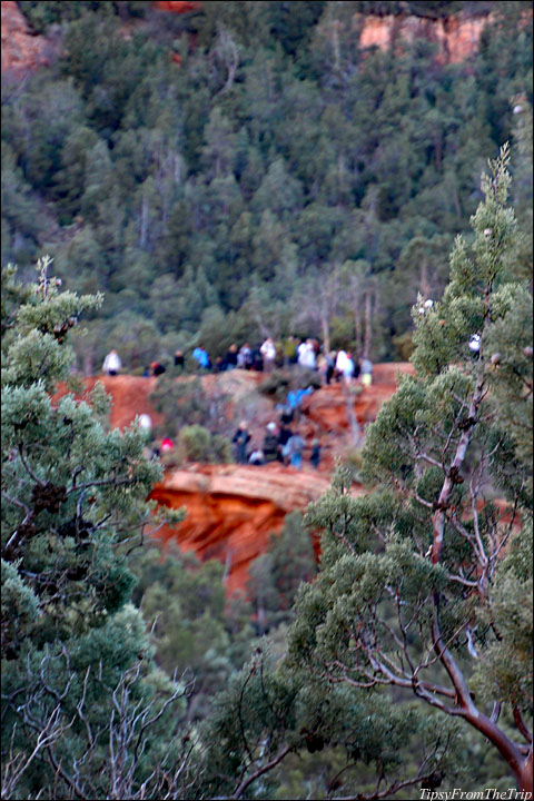
- It is a popular trail, so you’ll have quite a lot of company if you’re on it on a weekend or a holiday. If you want a quiet hike, you might want to arrive early.
- Arriving early has another perk — you won’t have parking problems at the lot where the paved part of Dry Creek ends. (We had to make a few rounds around the lot to find parking spots for the 2 cars that our group had come in.
- If you’d like to do some ATV-ing around here, you can drive through the unpaved 1 mile (and then take the trail to the bridge). You could also rent a jeep, or if you have a high-clearance vehicle, you can drive closer to the trail. (Our recommendation would be to ‘walk all the way.’ 😉
- Be aware: on a busy day, there might be a long line of people waiting to get to the top/ the last part of the hike, or take pictures on the bridge.
- If you’re travelling on a hot day, make sure to carry enough extra water for your hike through the rocky desert.
- Dogs are allowed on the trail, but they’ve got to be on a leash.
Other routes to Devil’s Bridge:
Mescal Trailhead
Chuck Wagon Trail
More from the area:
Sedona, AZ
Look for these Famous Red Rocks when in Sedona
Ancient Apartments — Montezuma Castle
Meteor Crater – A Crash Site in the Desert
Linking to —
My Corner of the World

Wow must have been exhilirating!
I love red rock landscapes (all rocky ones, actually.) As for this particular hike, I didn’t feel the distance at all — because of the company. It was a good one.
Thank you for stopping by, Magiceye. 🙂
Looks amazing, Wonderful place.
Great series of pics.
🙂
Thanks a ton, Rupam.
I hope you are having a good week!
…wow, what a fabulous place. Mother Nature sculpted it beautifully!
I agree with you 100 percent, Tom.
I cannot get enough of the beauty of rock formations! So fascinating!
Thank you for coming this way. 🙂
That looks like an exciting adventure – thanks for sharing.
Have a funtastic weekend!
Welcome here, Valeria.
That was a great hike!
Thank you for visiting. 🙂
Wow, the landscape is unreal.
Devil’s Bridge looks amazing!
Stunned by your photos as always, Dee!
Right? You should also check out the post on Sedona’s famous red rocks. It’s gorgeous!
Thank you so much, Veronica.