
If you are driving from San Francisco, Highway 1 starts a little north of what many like to call Rainbow tunnel (on William T Bagley Freeway) where 101 forks and goes off to Mill Valley.
Once you turn left and enter Highway 1, be aware that you are driving into mountainous area. The highway goes up and down and up again before it makes a descent towards Stinson Beach.
It is a two-lane road around here and if there is fog, driving can be quite difficult considering the many turns this highway takes around the Marin Hills. On a clear day, you will see the beautiful blue of the mighty Pacific on the left.
There are a few places where you can stop and take in the beauty of the Pacific Ocean and the Pacific coast. Most of the Shoreline Highway is craggy with small peaks and even some steep drops. Look out for Stinson Beach and Bolinas Bay as you drive down. The view is awesome.
Here are a few pictures from Shoreline Highway:


Stay tuned for more from drives along Highway 1. 🙂
—————————————————————————————————-
* Highway 1 is considered to be one of the most scenic routes in the United States. This highway which is actually California State Route 1 runs along the length of the state along he Pacific Coast. The pictures above are from the Shoreline Highway – the part of SR 1 that lies north of San Francisco Bay Area.
Towards the central Coast of California, Highway 1 comes to be called Cabrillo Highway.
It runs all the way to Orange County in Southern California
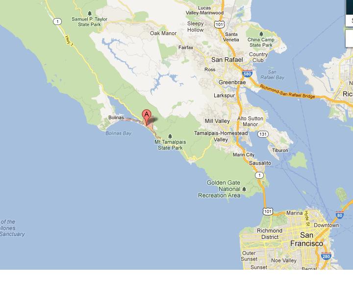 |
| Shoreline Highway/Highway 1 and Stinson Beach (A) [Google Maps] |
You might also want to check out this attraction on the Central Coast of California:
17 – Mile Drive

Awesome captures from the highway. Have read a lot about this Highway. Would love to do it someday. Lovely article Nambiar.
http://rajniranjandas.blogspot.in/2012/09/belum-caves-deep-down-under.html
Thank you Niranjan.
…And I'd love to see all the pictures and hear about your coastal drive and experiences.
Hey, the Belum Caves post was outstanding.
Hmm That has triggered an urge to go on a long drive…One thing I really miss here 🙂
Jaish, do it this weekend — go on a nice long drive. Don't forget to write about it.
B-E-A-U-T-I-F-U-L pics. The West Coast is blessed with scenic views all along.
Yes Kishan, blessed indeed. I got to do another stretch of Highway 1 a few days after this. The sad part is that it can get terribly foggy, even in the middle of summer. Not that fog isn't beautiful but driving through it could be pretty dangerous. 🙁
WOW! Those views are heavenly! I am all tuned for everything that is to follow, please put it up soon 🙂
Yes, maam. 🙂
Fabulous photos Divya:) and I want more pleeease:)
Long live Highway 1!
Your wish is my command, Amit. 🙂
Spectacular views beautifully captured!
Thank you so much, Magiceye. You inspire me every day with those pictures of everyday-Mumbai.
A lovely picturesque post Divya:) The last issue of Lonely Planet magazine edition carried some wonderful write up and pictures of drive from LA to SFO!
Yeah? I would love to read that. It's the same highway. The LA- SF stretch is the more travelled part. It's beautiful. 🙂
This is so pretty.
🙂
Superb post and fantastic snaps!! This wonderful drive is in my wishlist too 🙂
This is a must-do, Ashwini. You'll love it, I'm sure. 🙂
Thank you. 🙂
Highway 1. 🙂 I loved driving through this area.
I'm sure you did, Nona. There's nothing like that, right?
We did the northern most part of Highway 1 recently; from the place where 1 actually starts till Mendocino(town).
Simply want to say your article is as amazing. The clearness in your post is simply excellent and that i can think you're an expert on this subject. Fine together with your permission let me to clutch your feed to keep updated with impending post. Thank you 1,000,000 and please continue the rewarding work.
My web blog :: lucky strike original red
Beautiful place to drive through. I like that second shot.
Thanks Rajesh. You've done some Highway 1 driving, right?
I am going to drive on these roads some day
You must, Shrinidhi. You'll fall in love with Highway 1 and it'll be a drive you'll never forget.
Dreamy pics, Divya:)) Have read about the Highways…got some glimpses today. Waiting for more…
Fab blog!!Thanks for sharing…
More pictures will come, I promise.
Aww…Thank you so much. Thanks for all the support. It's such a joy to share these posts with people like you. 🙂 Have a beautiful weekend.
beautiful photos…
thanks for sharing…
My pleasure Krishna. Thank you for dropping by. 🙂
Spectacular shots Divya
Thank you, Mr. Ramakrishnan. 🙂
What a place..! You are so lucky, love all the pictures, every single one 😀
Thank you so much, Ghazala. I'm so glad you like them. You're lucky too … I share all these with you. 😉
Ahhhh….a these pictures…a relief to eye !
Love,
Bong's Belleza
🙂
Who doesn't like drive by the seaside, right? Thank you Ayantika.
It is awesome, I will plan my next trip there.:) Thanks!
California's calling! 🙂
You'll love CA, Saru.
This post made me so nistalgic. We did the Highway 1 stretch last year and finished at San Diego.
That must be from SF to San Diego, right? I'm sure it was a great experience.
These pictures are from the part north of SF. It's foggier around here, even at noon. 🙂
Someday I plan to drive down the Highway No 1. Till then, I'll have to be content with the reflected glories off your digital eyes! Those are great images.
We drove through another part of this highway a few days back. I'm going to be putting up those pictures too and luring you to CA. 😉 Let me know when you come this side. We should meet up, USP. 🙂
Wow!!
Isn't it! 🙂
wow wow wow, This reminds me of OZ, We had a few miles of a coast drive along the beautiful sea..
This is awesomeeeeeeeeeeeee
Bikram's
I've seen a few pictures of that road; that also along the Pacific :). Cool, na? I'm sure you loved that drive, we can never get tired of the sea, right?
Wow, breathtaking views of PCH. It looks lovely in the pics, in reality it must have been even more mesmerizing 🙂
Looking forward to the day when I shall travel on this freeway 🙂
Regards,
Jay
http://road-to-sanitarium.blogspot.in/
It was. But they can get very foggy even in the middle of the summer and that can dampen the trip. The day we visited Stinson Beach (above) the fog was just moving away so it was ok. On another day when we were doing the northernmost stretch of the highway, visibility was very poor. We could barely see the roads and the couldn't see the ocean at all. :(.